
Water Resource Projects
All of the projects below were undertaken by Bangladesh Government and implemented by Bangladesh Water Development Board (BWDB) under the Ministry of Water Resource (MoWR), Bangladesh Republic.
Re-Excavation of Small River, Canals and Reservoir In 64 Districts
Duration: 2018-2021

I participated in the design and implementation of the restoration of three natural channels, which were 7km, 32km, and 55km in length. To collect survey data, we utilized both a Theodolite-Level survey and satellite imagery. We relied on our own BWDB manual to guide the design process and also used the HEC-RAS model to analyze yearly sedimentation patterns and ensure appropriate channel depth. For our vegetation strategy, we opted to implement close turfing on the banks and planted Vetiver grass along both sides. The effectiveness of the Vetiver grass was particularly notable in protecting against the erosion of loose soil. The picture below has presented to show before and after restoration program.

Command Area Development of Teesta Irrigation Project
Duration: 2021-2024


The aim of the project was to rehabilitate of Teesta Irrigation project consisting of strengthening of irrigation canal’s dykes, repairing and constructing hydraulic structures, and re-excavation of reservoirs. I was involved as an engineer in charge of five secondary irrigation canals. The map shown here was developed by me and one of my colleagues, Mr. Farukuzzaman using Arc-GIS. Canals were designed using the theory of Kennedy and Lacy. The formulas were incorporated into MS Excel to determine the canal’s cross-section. Similarly, the design of hydraulic structures (regulators, siphons, check-drops) was done through MS Excel using the BWDB design manual.

Straightening of Charalkata River and River Bank Protection of Buriteesta River
Duration: 2020-2022
In my role, I was primarily involved in ‘Bank Revetment’ and Flood Embankment of 2.83 Km bank of both sides of Buriteesta river- part of the project- which required conducting an analysis of river erosion and sedimentation using the Delft3D-FLOW model. To protect the riverbank, we utilized a combination of measures including CC blocks, Geo bags, Geo filters, and vegetation. These measures were crucial in ensuring the stability and integrity of the riverbank, and in minimizing the risk of erosion and associated damage. Here, a design of bank revetment, flood embankment and project Map & image has been shown as evidence of my works.


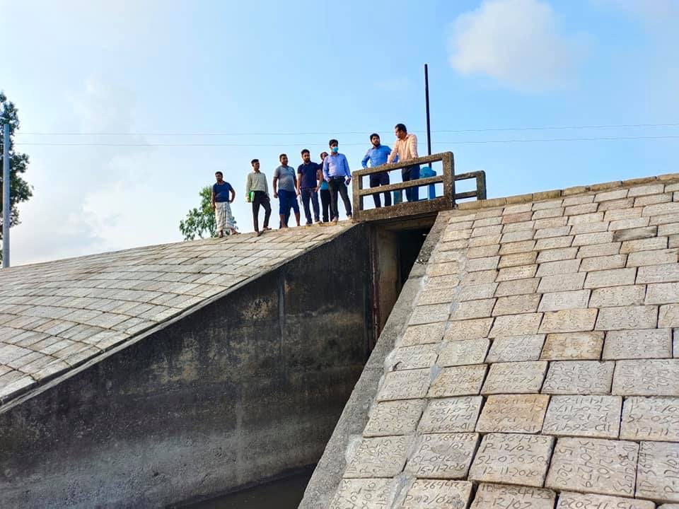
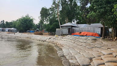
Flood Fighting during Emergency Situation
To address emergency situations during floods, we implemented several measures to reinforce affected riverbanks. One of these measures involved designing riverbanks using bamboo profiles and wood materials. In addition, we utilized geotextile bags filled with sand, carefully chosen according to their weight and size as specified by the design. These measures were aimed at reinforcing the riverbanks and mitigating the impact of floods, ensuring the safety of the surrounding communities, and minimizing damage to property and infrastructure. Here are some snaps of my activity with my team.
.jpg)
PROTECTION AGAINST BANK EROSION OF TEESTA RIVER
Considering & analysing the previous study/reports, observations of BWDB throughout the years, available hydro-morphological, frequent field visits, environmental, climate data from primary & secondary sources, stake-holder consultations, present performance of bank protection & river training works (RTW) implemented at different locations of the river and objectives of the study project, firstly we proceeds with a hydro-morphological 2D model. The developed 2D- morphological model has been applied to estimate probable bank erosion during High Flood and Average Flood events. The amount of forecasted bank erosion at different locations illustrates the erosion prone /vulnerable ranches. It can be seen from model simulation result that substantial bank erosion may occur at Parulia, Binbinia Ghat, Kashiabarihat, Mohishkhocha, Kalmati, Khuniagach, Kaunia and downstream of Kaunia Bridge in the left bank and Kharibari, Shoulmari, Alam Biditar, Kolkonda, Tepa Modhupur and Char Bidyananda in the right bank. In total 111.021km length has been proposed for bank protection work.

